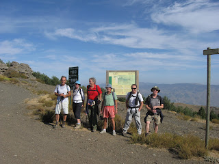
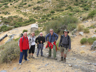
The start of it

For a long time, whilst out walking in the Sierra Nevada Mountains, we have come across footpath signs to Sulayr but we were never able to connect the signs to any known path, they always seemed to point to somewhere high in the Sierra Nevada. Then in August 2009 whilst on the Mulhacen mountain bus Paco, the guide, explained that it was a 300 km circular path running around the Sierra Nevada National park.
Slowly my interest in this walk was aroused, but it always looked like it would be a ambition never undertaken. The path runs around the Sierras at about 2000 meters, and the thought of taking our poor little Renault Kangoo up all those access tracks to the start of a new section of the walk filled me with dread, it was our only car.
In 2011 the chance came to buy another car, and the thought of walking the Sulayr path gained momentum. What was needed were some good buddies to share the experience. My wife has always classed the “The A Team” of the Lecrin Valley Limpers as something out of “The Last of the Summer Wine”. A group of old men who go out in to the mountains for the day and come home raggy arsed, tired and dirty. After careful consultation with fellow team members who jumped at the chance of expeditions into the high Sierras I decided to buy a small 4X4.
This is the story as it unfolds.

Thursday, December 22, 2011

20 December 2011 Section 12 to Las Rozas


Las Rozas

After the outing on the 1st of November we have not been able to do a section of the walk. Firstly  we had a heavy fall of snow that came down below the level of the track, then holidays, sickness and a chill wind have kept us away from our walk. This does not mean we have not been out enjoying ourselves. We have found a new project in the Alpujarras, the GR142 which runs below the snow line and we have also slotted in various other walks to keep us entertained.
This week, with the snow in retreat and the temperature starting to climb, we decided to put the project back on track. There was a short 9 km section at the far end of the Sierras that we have not completed, it does not attain a great deal of height so we thought we would clear it off the list.
With a long drive ahead off us, and around the shortest day of the year, we thought it best to get another early 7.30 start.
The drive up was good, and there is only a short section to drive on the forest path before we reached the starting point for the walk. We were last here on the 22nd of September, and we had then walked in the opposite direction to Collado Hauerteliclos.
We set off at a good pace on the easy forest road which was going to take us all the way to La Roza, our turnaround point. The footpath sign said it was only 8.8 km so this was going to be the easiest walk of the lot. The area is heavily forested, and the medio ambiente were busy extracting timber, the whole hillside was alive to the sound of chainsaws, at least we did not see any tree huggers this time. The Lumberjacks and Jackies were using horses to move the wood about, these appeared to be a breed specially bred for the job, stocky and very powerful and that was the women.
We were amazed when, in no time at all, we arrived at Las Rozas, the GPS said we had travelled only 7.1 km. Turning around we retraced our steps and we were back at the car by 1pm. This presented us with a problem, we could not go home, we are not expected back till it is getting dark. On the walk we had noticed a large building about a km off the track, so we decided to drive down and investigate it. It turned out to be Aula Naturaleza Paredes, the grounds of which were open but the buildings were closed, but it was a nice place to stop for lunch. I had just got stuck into my sarnies when a warden appeared and told us he was off home for his lunch and would be locking the gates. Packing up we decided to head home by the slow route down through the Alpujaras.
We stopped off in Cadiar for a beer and tapas at a very friendly bar run by a English woman.
We arrived home just after 5, not a long walk, but we had to do it, and the sun had shone all day.     

       
The walkers Mike, Kees, Plym, Ray, and myself.

Distance walked on route today, 7.1. km. Total distance today 14.2 km. Height climbed today 352 metres. Total distance walked on the Sulayr path 221.6 km. Distance left to do 78.4 km. Total height climbed 17565 metres. Total distance walked 514.5 km.  

Thursday, November 3, 2011

1 November 2011 Section 17 to the Lavaderos de la Reina


Lavaderos de la Reina

This week we did a section of the walk that is difficult to access, It is in the middle of section 17. We have done either end of it previously, but the middle bit involves an 8.3 km walk to get to the start of the path. We had left it until this week because we understood that the Autumn colours on the route were spectacular.
With another 7 am start we drove to Purullena, where we had arranged to meet Mark and Plym, before driving to Lugros and the off road section which would take us to the start of the walk. Normally when we hit the dirt road it heads up hill towards the Sulayr path saving us a considerable amount of effort in getting up there, but this week the road was virtually flat. After about 3 km of driving we came to a gate across the road and the starting point for our walk. Up until the gate the road had been a rough track, the other side someone had gone to considerable expense to lay a slate tiled road surface. The road was in a steep sided wooded valley and, as it slowly climbed, the colours of the trees became more intense, changing from yellows at the bottom through orange to deep reds at the top. We followed the tiled road for about 4 km until we eventually arrived at what we thought must be stock pens where they auctioned the cattle that roam in the hills. With such an expensive road we had been expecting a hotel or mansion, but no, just a cattle pen!
From here the road left the trees behind and went back to what we are used to, a dirt track. At one point a Golden Eagle flew past us no more than 15 metres away, I was so mesmerised that I did not manage to get my camera out, it would have made David Attenbrough jealous. It took us 2.5 hours to reach the start of the Sulayr path, which we then followed towards the Lavaderos de la Reina.
This is the third time we have visited this magnificent valley looking for the Sulayr path, on both previous occasions we have approached it from the other direction and we have been unable to see where the path went, hence one of the reasons for coming in from this direction. The path is difficult to follow but because we now knew where we wanted to be we did not have a problem and we arrived at our destination in time for lunch. You could not get a better place to stop, it was superb, but with the cloud starting to roll in and the temperature dropping we thought it best to head back, not only had we the 12 km walk back to do. We also wanted to walk back towards Postero Alto and to the end of the trail we had been to on July 8 2011.
Over the course of our Sulayr walk we have awarded Brownie points to members of the group who have shown outstanding leadership or path finding abilities. In Britain they are looked upon like a medal of honour, something to be proud of. So it came as a shock to discover two of the group, and I will not name them to save embarrassment but, they are both Dutch. One who does not have Brownie points was trying to buy some for a bar of chocolate, the other who was selling also does not have any either, this was a blatant attempt at short selling. I know this kind of thing goes on in the European Union, but in our group it is banned. Let this be a lesson, no more sneaky foreigner tricks, if you want to buy some Brownie points see me.
In the past we have had discussions regarding whether water in an acequia (canal) can flow up hill. I tend to go along with the general scientific observation that it can’t, but there are those amongst us who believe that a 1000 years ago the Arabs discovered an ingenious method of lifting water without the use of energy. Well once again we were walking by an acequia when the cry went out, “look the water is going up hill”. If we didn’t need oil to create energy Gaddafi would be still alive and living in his tent and we would have perpetual motion.  
We walked back along the Sulayr track until we came to the point we had reached previously. We have now completed the whole of the north side of the walk, a magnificent achievement. Plym has a maximum limit of 30 km at which point she falls over, so we approached our return journey with some trepidation as it would be be touch or go as to whether she would be able to make it back. We did consider the possibility of carrying her, but this would have slowed us down somewhat and we were looking forward to our beer and tapas. We arrived back with 300 metres to spare, pretty good planning and at least she did not have to spend the night on the hills.
On the drive out we had passed a lot of cave houses in a village called Marchal, we thought we might be able to find a cave bar in the village so we headed there for our refreshment. What a miserable place, not even a bar so we headed back to our morning coffee stop in Purullena.
We had had a long day but it was a fantastic walk, one of the best to date. Every section so far has been great, it is going to be difficult to vote for the best one.    
       
The walkers Mike, Kees, Rene, Plym, Graham, Mark, and myself.

Distance walked on route today, 6. km. Total distance today 29.7 km. Height climbed today 1178 metres. Total distance walked on the Sulayr path 214.5 km. Distance left to do 85.5 km. Total height climbed 17213 metres. Total distance walked 500.3 km.  

Thursday, October 27, 2011

25 th October 2011 El Rosal to El Toril


Cold on El Toril


For a while Mike has been talking about doing a walk greater than 26.3 km, this was his previous personal best achieved on an earlier walk , I have kept hoping his silly idea would go away, and leave us just to potter away on our mission to conquer Sulayr. Last week he said he had found a part of section 14 from El Rosal to El Toril that we still needed to do finish, and with a return journey of 28 km it would fulfill his ambition. Not wanting to disappoint the lad we put it down for  this weeks challenge. This was not going to be a Micky Mouse walk, it would sort the men from the boys.
The weather has suddenly changed from beautiful Autumn days to wet and unpredictable, but luckily the forecast for our Tuesday walk in the mountains was for sunshine. Once again it was a long 140km drive to the start of the walk, necessitating another 7 am start. We left Rene’s car in Granada and, driving in convoy with Marks trusty little Renault following on behind us, we headed for our start above the village of Huéneja.
We had tried to do a section of this walk on the 3rd of May, but the weather was wet when we arrived so we only managed a short section from La Rosal to Piedra Negra. So our starting point this week should have been La Rosal but I had a better plan. We would park about 3 km short of La Rosal then, without packs, we would have a rapid walk on a level forest road there and back to the car,after that loading up with the packs we would  continue on with the next 22 km. The sun was shining as we set off, and whilst not hot it was a pleasant temperature for walking. Or it was until you were walking in the shade when the temperature fell to just above freezing, and then you remembered why you always carried a pack with hat, gloves and a warm jacket in it. The only option was to walk faster, arriving back at the car we discovered we had done 9km.
Now with full packs we set off again, but we let Plym go first to have a few moments on her own. When we were given the all clear to proceed there was no sign of her on the path, she had got herself lost and had only gone 25 metres.
The track headed up hill for a half hour, at the top we stopped for a bite to eat, by now the weather was changing again and the clouds were closing in on us, but the path was well marked and we felt it safe to proceed. For a large part the route is along a forest road. This is until you come to the end of it and it falls over a precipice. No signs, no barrier, no rocks, just a shear drop.
At this point the path takes to the forest again along a delightful meandering path. Our destination was El Toril, but the last time we were here, on the 24th May, there was a bit of confusion as to exactly where it was. Normally at the start of each tramo there is a sign board giving you directions. On this section the board is about 2 km short of the actual point, there must have been a logical reason for this but it escapes me. So we went back to a point we knew we had been to before, this was after Rene was caught making a cross on the road and claiming she put it there last time.
We had a quick lunch but, with the weather continuing to deteriorate, we were soon heading back the way we had come. One thing that has consistently caused a ruckus within the group has been the Pine Marten. Graham first claimed to have seen not one but two back on section 9 to Fuente del Espino. All I said at the time was that we needed a verifiable sighting for me to write it up into our erstwhile journal. All he produced in his defence was Mike who thought he had seen a fox with short legs, given the state of Mike’s eyes it could well have been just that. In this case both Kees and myself saw a short legged, large, cat sized animal with a yellowish tinge to it’s bib climbing a Pine tree, it was not a bloody squirrel as Graham suggested. This was a genuine Pine Marten.
The way back was once again along our outbound route and this time it was mostly a very easy downhill stroll. We celebrated the 26.3 km mark by drawing a line across the road and cheering Mike as he crossed it. We still had just short of 4 km to go to get back to the car so not only did he exceed his record, he smashed it. I have told him anymore records that he wants to break he is on is own.
The weather kept fine all day but at times it was a little chilly and we did need the warm clothing we had with us.
We drove back into Huéneja and eventually found a bar that served delicious tapas. so we will have to call again when we return to this end of the Sierra’s. The only problem was getting out of the Publeo. After driving up and down various blind alleyways made for donkeys we had to switch the Tomtom on to get us out, we had lost Mark somewhere whilst we were doing one of the many multipoint turns, we thought it best if we left him to find his own way home. Unfortunately for Rene when she got back to her car, she had been issued with a €100 fine for parking on a bit of waste land down at AKI. With all the stupid parking that goes on around Granada this just does not make any sense.
For the record it appears that the walk was too much for Graham to handle and he is now on the sick with a bad foot, he is claiming we walked too fast for him.
       
The walkers Mike, Kees, Rene, Plym, Graham, Mark, and myself.

Distance walked on route today, 14.8 km. Total distance today 29.6 km. Height climbed today 719 metres. Total distance walked on the Sulayr path 208.5 km. Distance left to do 91.5 km. Total height climbed 16,035 metres. Total distance walked 470.6 km.  


Thursday, October 13, 2011

11 October 2011 Postero Alto to Peñon del Herrero


Saved from certain death by the Lone Ranger


This week we headed back to the Refugio Postero Alto ( the Hobbit house we had last been to on the 18th July). This time we were walking East on section 16 towards Las Chorreras.
Once again with a long distance to travel we left at 7 am, but with Rene back from her holiday and Plym recovered from last week we needed two cars, Marks friend Kevin also wanted to come with us so we arranged to meet them in Granada and then proceeded to drive to Jérez del Marquesado. The last time we had driven up to the Refugio it was a rough old road but they had just been out with the grader. The road is now in good condition if a little dusty, poor Mark following on behind had no idea where he was going, he was in a dust cloud the whole way.
The path starts by following a fire break before heading in an easterly direction along the edge of the forest. It crosses a number of barrancos, each one becoming steeper the further we travelled.
We stopped at the top of Cerro de los Muertos, I know it was a climb but it was not that bad, for a bite to eat, before what we thought would be an easy down hill section to our destination. It was while we were relaxing and enjoying the views that we noticed that the way markings for our intended path had been marked with a cross and with new markings leading across the hillside. Not knowing any better we decided to follow the new route, well, it was not really a route, just a series of red and white markings scattered over the hillside in a haphazard fashion. What was worrying was that you could see our intended track far below, in the distance, but with no obvious way of getting there. Graham thought it best we continue along the new route. Just when things were looking pretty hopeless and that the “hill of the dead” would claim some more victims, in true Hollywood style “The Loan Ranger on his faithful horse Silver” came racing over the hillside, this guy must have been a stunt man in the old Spaghetti movies, filmed just down the road, he and his horse were fearless . All that was missing was his six shooter, Tonto and a posse of Indians. Fearing the worst we re-grouped into a protective circle and put the women at the front to protect us. Skidding to a halt in front of us he told us our route was mal and that we faced a certain death if we continued, he said that vandals had come in the middle of the night a while back and painted these signs all over the hill.
We had two choices, we could either return and pick up the proper path or he could guide us to a acequia which we could follow and get back to our path. So following his lead we headed off after him as he guided us safely across the hillside to the acequia, which we then followed for a couple of kilometres and rejoined our track. It was now only a short walk to Penón del Herrero which was our destination for the day.
After a quick lunch we started back the way we had come but at the junction with the acequia we followed the correct waymarked path down and into the barranco of the Rio Publeo. The guide book mentions that impressive boulders threaten to come rolling down the hillside into the barranco and indeed this is what looks to have happened a while back and hence the unofficial diversion, it is a pity that the signs are still there even though the correct route is now  restored. Climbing back to the summit of Cerro de los Muertos we stopped for a quick refreshment break, poor Kees had all his brownie points removed by Graham for having raced off to the summit whilst the rest of us struggled up the hill. We could see our destination of Postero Alto only 3 km away in a straight line but with all the barrancos obstructing the route we still had 7 km to go. Arriving back and disappointingly finding the refugio closed we headed off to find a bar in Jérez de Marquesado, the only one we knew of was also closed, so we had to wait until Guadix for our cooling beer.
It was a good walk and while the diversion could have led to a tricky situation our Cowboy made it a great day out.
   
The walkers Mike, Kees, Rene, Plym, Graham, Mark, Kevin and myself.

Distance walked on route today, 11.2 km. Total distance today 22.5 km. Height climbed today 906 metres. Total distance walked on the Sulayr path 193.7 km. Distance left to do 106.3 km. Total height climbed 15,316 metres. Total distance walked 441 km.  

Friday, October 7, 2011

4 October 2011 Section 18 Rio Vadillo


A short break after the steep climb

Our mission this week was to do a short section of tramo 18 that is difficult to get at, we have twice made attempts at it and failed. The first time was on the 31st of May when we were beaten by a chain across the road, and by the time we had walked the 6km to the start of the walk the prospect of another 18 km and a 600 metre climb was too daunting.The second time was on the 25th August when the sun was at its hottest, we did manage a short 2km 350 metre climb of the section. Can I just say we did not spend all day on the hills just walking 2km. I know the wives think we are using the walk as an excuse to get out of their way and that we spend all day in the bar, in reality we are just trying make sure that at least one group of walkers have managed to complete the full 300 km. We feel very honoured, it is like the whole thing was created just for us.
What we needed to do was a 4.2km section along the Rio Vadillo, from below Peña Partida to the refugio El Calvario. The other part of the walk down the “Vereda de la Estrella” we have done many times, it is the classic walk of Granada, even David Cameron (British PM 2010-2015) did it this year.
We had a late 8 am start and picked Mark up in Gúéjar Sierra and then continued to the start of the walk at San Juan in the Maitena gorge. We substituted Rene this week for Plym who was desperate to get into the high mountains after spending the summer in Devon. The weather forecast was not too promising and I had issued a wet weather gear notice the day before. In true Plym style she turned up with her jacket tied around her waist and 2 Bananas in her pocket. For the first hour the route is very easy along the Estrella path high above the Rio Genil. The track was used for access to the various mines that existed up until the civil war. After this things start to toughen up, the path heads down hill, crosses the river and for the next hour climbs up the Cuesta de los Presidiarios to the Calvario refugio. This is not one of the big manned ones, but it does have bunks and it is dry if you are caught out in a storm. At this point the path splits, one track continuing as a high level route that eventually rejoins the Estrella path and the other our route to Peña Partida. This is the section we had come to do, it is an important junction in the path but as always when you need a marker there is nothing. After a short but very steep section we left the Rio Genil valley behind us and headed for the Rio Vadillo. The path was easy as it headed for our destination in a forest at the far end of the valley. Graham was on point duty and can usually be relied upon to navigate the route, I was second and just following the leader. Third was Kees who put all his recent training into good practice when he spotted a marker sign and path our leader had missed, if Kees continues the good work he may graduate to his “Path finder badge grade 2”, Graham was sent to the back.
All that was left to do now was link up with the path we had done in August which was somewhere in the forest. Mike was convinced that it was somewhere near the beginning and had slowed down in preparation for his well deserved lunch. Unfortunately the junction was still a little distance away, some may question the word “little” as I understand there was a growing mutiny taking place at the rear. Normally we look for somewhere either comfy or with a view for our lunch stop but today, after climbing 1068 metres, we just slumped by the side of the path when we reached our destination and greedily tucked into our sandwiches, even Plym looked on enviously whilst eating her banana.
With storm clouds gathering over Veleta we decided it was high time we hi-tailed it back down the hill, Mike is not too keen on spending a night in a refugio.
Once again we had no option but to return back along our outbound route, the only problem was some of the sections were quite steep and the knees can take quite a pounding, we are not known as the “Lecrin Valley Limpers” for nothing. Plym suffered the most this week and by the time we got back to the car she was hobbling quite badly but assured us that with a good sleep her knees would return to normal.
We stopped off in Gúéjar Sierra for a well deserved beer before our journey back to the valley. In the end the impending storm did not develop and we did not need our rain gear, another excellent day out in the hills.
   
The walkers Mike, Kees, Plym, Graham, Mark and myself.

Distance walked on route today, 4.2 km. Total distance today 23.2 km. Height climbed today 1185 metres. Total distance walked on the Sulayr path 182.5 km. Distance left to do 117.5 km. Total height climbed 14,410 metres. Total distance walked 418.5 km.  

Thursday, September 29, 2011

27 September Section10 A337 to Rio Paterna


Foot bridge Barranco del Riachuelo

Another week another walk, with the weather conditions absolutely perfect for mountain walking. Once again a 7am start was called for, to gain maximum day light. Our walk this week was on section 10 in the Alpujarras, but the quickest way there was the Northern route around Guadix. We had arranged to meet Mark in a bar in La Calahorra for coffee before driving another 30 km to the start of our walk.
The first part of the walk was a 2.5 km section on tramo 9, we had failed to complete this part due to a threatening thunder storm back on the 21 st June. Access is very easy because the path crosses the A337, which is the only drivable route over the Sierra Nevada from La Calahorra to Laroles. Not that you know where the path is, another unique opportunity lost to promote this path. No signs by the side of the road, you even have to climb over the crash barrier at the side of the road to access the path, you then discover the footpath sign down the hillside, hidden from the road.
When planning the walks I try and arrange for all the steep climbing to be done in the morning, much preferring these sections to be done whilst we are still fresh. The lay of the land forbid this on this occasion. We were going to have to climb about 450 metres in the morning and some 650 on the way back plus walk about 25 km. It was going to be a long day in the saddle, unfortunately we only had shanks´s pony.
The path heads down to the Rio Palancón and across a well constructed footbridge, and then heads up to the Bayárcol road. It was while we were going up this path that a commotion broke out behind me, stopping to investigate we found Mark hopping about proclaiming loudly that he had been stung on the leg by a wasp. After receiving first aid we set off again only for Rene to succumb to these blessed things. There must be a new breed of aggressive wasps about this year, a lot of people are getting stung.
After passing through an old Holm oak forrest we arrived at the start of Section 10. The path follows a campo road to start with before heading down into the Barranco del Riachuelo. The river crossing is made on an old pack horse bridge beautifully constructed, but with an unusual lean, we could not work out if it had been built this way or over time its foundations had shifted. We now had a stiff climb up a hillside and into a pine forest, fortunately it was still cool and the vistas opened up the higher we climbed. No sooner had we reached our maximum altitude of 1845m than we started the long descent down to the Rio Paterna. The path is in a pine forest for much of the way, and whilst the temperature was starting to rise it was remaining cool in the forest, this would be handy on the way back. There is evidence all around that the area was once extensively farmed but nowadays most of the farms appeared to be abandoned, what a shame, but who can blame anyone from moving on from what must have been a very difficult life.
As we were descending down into Barranco Paterna we were rewarded with a magnificent flying display from a pair of Golden Eagles, what a wonderful sight and it was the icing on the cake on what was turning out to be one of the best Sulayr walks we had done.
The Rio Paterna was our turn around point for the walk, We all look forward to a return visit when we do the next part of this section, it is a wonderful isolated valley. Usually we stop for lunch around the halfway point but with a 490 metre, 6 km climb out of the valley I suggested we waited until we had reached the summit, knowing how lethargic I get after food. The tactic worked well, we were up the hillside in double quick time and we stopped for lunch in the shade over looking the Alpujarras.
With the hard part of the walk over, we only had 148 metres left to climb, we were able to enjoy our walk back to the car. The only difficulty would be the area around those pesky wasps. Graham and Kees were given the short straws because they were wearing long trousers, so less of an area to get stung on, they went at the back. We  ran down the track, passing the wasp nest by the side of the path on the way. We must have disturbed their early morning slumbers on the way out, no wonder they were bad tempered.
With the walk over our thoughts once again returned to the important subject of cold beer. The nearest bar was back in La Calahorra at our morning coffee stop. Such was the hurry to get there Mark forgot he had put his walking poles on the car roof, they came off at the first of the many corners on this twisting road.
This was a great day out, even if it was nearly dark when we got back, Mike suggests we return in 10 years time to see if we can still do it as quick, by then there might be All Terrain Zimmer frames available.
  
The walkers Mike, Kees, Rene, Graham, Mark and myself.

Distance walked on route today, 12.6 km. Total distance today 25.37 km. Height climbed today 1052  metres. Total distance walked on the Sulayr path 178.3 km. Distance left to do 121.7 km. Total height climbed 13,225 metres. Total distance walked 395.3 km.  

Saturday, September 24, 2011

22 September 2011 Section 12 La Polarda


La Polarda

With one day to go before the Autumnal equinox the available day light is getting shorter, we are losing about 15 minutes a week at the moment. We thought it best to try and get some of the sections in Almeria Provence done as these involve a considerable amount of driving time to get to the start of the walk.
Section 12 is at the far end of the Sierra Nevada range and, at 150 km it is one of the longest drives, fortunately there is only a short off road bit to do. We met at 7am at the Cozvijar petrol station, the attendant looked incredulously at us when we said we were going off walking, it was  pitch black, the sun would not be up for another hour.
We had arranged to meet Mark at an obscure motorway junction near Guadix as he lives that side of Granada, but luckily we caught him up on the motorway. So proceeding in two cars we made our way to Abla, our gateway village up into the Sierra Nevada. The off road section to the start of the walks is often  long, and sometimes over difficult terrain, but this weeks forest track was short and in excellent condition.
Plan A was to start in the middle of section 12 and walk to the start of it, at La Polarda, a distance of only 7.5 km, but involving a climb of around 600 metres. Both Rene and myself had had funny turns whilst walking the previous Sunday and so we did not want to push it. We had put it down to not eating enough for breakfast, with this in mind we started the walk by eating muesli bars and setting an easy pace.
The path starts in a pine forest and climbs quite steeply on a good track which eventually leads into an oak forest with extensive views in all directions. The guide book says the area was mined up until the 1940s but nowadays there is little evidence of the workings, just a few abandoned cortijos scattered about the hillsides.
We soon arrived at our destination of La Polarda, a lofty perch some 2000 metres up. Our new diet obviously worked well, we were fit and eager to continue the walk.
We had to show Graham we had not lapsed into Micky Mouse walkers in his absence, so we opted to put our second plan into operation. Plan B was to extend the walk by continuing a further 4.5 km along section 11, it would have been a shame to turn around because the conditions were perfect and the going was easy.
The path slowly descended down into the delightful Barranco de Ohanes with its rock pools. Rene suggested we could go swimming but as she did not have her swim suit she declined to lead the way. The path then climbs up to Collado de los Huertecillos, our terminus and lunch stop for the day, our chosen spot was on rocks in the shade of some pine trees.
Our return was back along our outbound route. It was a delightful path in stunning country side which takes the Sulayr path out of the Alpujarras and into the Guadix plain. We did not see one other person all day, what a shame this area is so under utilized.
Arriving back at the cars our thoughts turned to a cool beer. Returning to the Publeo of Abla we eventually found a Bar after several U turns in the middle of the road.
Now the last time we had been in this area we had trouble ordering drinks as they did not understand our brand of Spanish. We thought it best to try a new linguist not tainted with a Durcal accent. We sent Graham off with our order because he is more wildly travelled than the rest of us Hillbillies and surprisingly he came back with the correct order but without tapas, but we were in Almeria provence.
We arrived back in the valley 12 hours after setting off, an excellent day out.   

The walkers Mike, Kees, Rene, Graham, Mark and myself.

Distance walked on route today, 11.9 km. Total distance today 23.8 km. Height climbed today 991 metres. Total distance walked on the Sulayr path 165.7 km. Distance left to do 134.3 km. Total height climbed 12173 metres. Total distance walked 369.9 km.  

Friday, September 16, 2011

September 8 2011 Section 1 San Jerónimo


At the visitor centre

This week we had a large turnout for our Sulayr walk, along with the usual suspects Mark and Graham have returned to Spain after their vacation in the UK, and Graham’s son Danny was out for a holiday as well.
This necessitated a rethink to our usual off road expeditions, we needed somewhere where a main road crossed the path and was not too far from home because Kees had to be home early to pack for his holidays. We had driven along the 6.9 km track that is used as the path for section 1 back in June but we can’t count that towards our grand total. Mind you if we are still plodding away at this walk for a few more years we might be all reduced to driving along the tracks in order to complete it.   
Now foolishly I expected that as we were doing a circular walk the start and finish point would be the same, well that makes sense to me. I knew where the walk ended, it was at the Dornajo Visitors centre on the A 395 Sierra Nevada road, so we all met there. I thought this would be a good place to take a photo of our expanded group, in front of the sign proclaiming the start of the longest circular footpath in Spain. There is no sign, nada, nunca, nothing. You could be in Siberia for all the information that is available, what a lost opportunity to inspire folk to walk the path. When we had driven the route we had come out by the Hotel Don José 100 metres down the road so we set off for this point, there were still no signs. Walking behind a small hill, hidden from the road and facing the wrong way, we came across a sign board for the walk. No wonder we have never seen anyone else doing the walk!
The path is along an easy forest track that heads down to the Rio Monachil from where we had done the second part of section 1 in June. We made rapid progress to the river stopping to do a bit of blackberry and apple scrumping along the way. I knew this was going to be a short section, but if we had turned around as usual when we reached the river we would have been back at the cars by 12 am. Obviously this was not acceptable, we had not even raised a sweat.
The map was showing a path that needed to be explored up the barranco Dehesilla so we set off to extend our day out. The path turned out to be a delight, in a hidden valley forested with a large variety of trees. We will have to come back sometime and explore it further. After a suitable extension, and with the temperature starting to climb, we made our way back to the Rio Monachil.
Dan decided to stop for a quick swim in the river whilst the rest of us started the 300 metre, 6km climb  to get back to the cars. As we were passing the Don José we decided to stop for a beer, this turned out to be very expensive, it will definitely not be on the list of bars to call at again.

  
The walkers Mike, Kees, Ray, Rene, Graham, Danny, Mark and myself.

Distance walked on route today, 6.9 km. Total distance today 18.3 km. Height climbed today 349 metres. Total distance walked on the Sulayr path 153.8 km. Distance left to do 146.2 km. Total height climbed 11182 metres. Total distance walked 346.1 km.  

Monday, September 5, 2011

2 September 2011 Section 16 Las Chorreras


The five at Las Chorreras

We were joined on our walk this week by Rene who has been chilling out in the UK for the past couple of months while the rest of us have had to stay here with the blue sky and sun all summer.
All week the weather forecast had been predicting a poor Friday, but it was the only day we were all free. By Thursday evening we were told to expect rain, snow and thunderstorms, good grief it is only the beginning of September. Friday morning we awoke to a short shower but then the clouds cleared away.
We had an early, 7.30 am, start for the 130 km drive to the start of our walk above the pueblo of Lanteira. Unfortunately, the further we drove the lower the clouds became, and by the time we had reached our destination on Peñon de Herrero we were shrouded in cloud.
We had driven as far as we could get but the track was deteriorating so we left the car and walked the 2km to the start of the walk.
We had not gone far when we came across a dog walking down the track. He looked happy but his ribs were showing so Rene took pity on him and offered him a sweet, one sniff and he carried on with his exploring, mind, it was a kids fried egg jelly sweet so you can’t blame him. A little further on we came across his mate who had been left in charge of the herd of goats . Picking up the Sulayr path we set off across the loma El Púlpito,  we could have been anywhere, we could not see anything. The path, whilst never climbing steeply, wandered in and out of various barrancos. The streams were still running  from last winter's snows.
Hearing a noise behind us we were rewarded with the sight of a wild boar and her youngsters making their way across the hillside, add to this two foxes we saw on the drive up through the forest, Buzzards and Bee eaters and it was turning into a wildlife extravaganza. Some walks you have fantastic views and no wild life, but with today’s cloud our views were restricted to our immediate vicinity and there was plenty to see.
Eventually we arrived at our destination of Las Chorreras, a Shepherds hut that we had walked to on the 24th May. Stopping here for lunch, we watched as the clouds slowly rolled back revealing the hills and valleys we had traveled through. We walked back the way we had come but it was a totally new experience having the benefit of distant vistas. We were plagued with a few light showers on the way back, but nothing like the prediction.The walk never appeared hard, but we were all pretty tired when we got back to the car and we looked a right bunch of old crocks when we staggered into the bar in Jézez del Marquesado thirty minutes later.
The drive back was notable for the fact that for the second time in this area we were pulled over by the Guardia, this time I was breathalysed, I am pleased to report that the sin Cerveza beer I had did not register on the meter.
  
The walkers Mike, Kees, Ray, Rene and myself.

Distance walked on route today, 9.3 km. Total distance today 23 km. Height climbed today 712 metres. Total distance walked on the Sulayr path 146.3 km. Distance left to do 154.7 km. Total height climbed 10833 metres. Total distance walked 327.8 km.  


Saturday, August 27, 2011

25 August 2011 Section 18 Peña Partida the steep bit


It’s nearly 6 weeks since we have done a section of the Sulayr walk, instead we have been walking at higher altitudes in order to escape the summer heat.
For our return we chose to go back to the highest part of the walk at section 18 Peña Partida. We had previously attempted to do this section on the 31st May but our plans were thwarted when we had to abandon the car some 6 km short of our destination due to a chain across the road. This time forewarned, we planned to do the section using some newly discovered paths. We drove  from Gúéjar Síerra on the spectacular campo road up Loma Papeles and once again parked where the road is closed. Careful research had revealed a previously unseen path crossing the hillside from the carpark. The path virtually contoured all the way around the valley and in a lot of places it was very well constructed very similar to the miners Vereda Estrella track lower down the valley.
After a couple of hours we met up with the Sulayr path coming down from Peña Partida. Along the route we had discussed a number of possibilities for extending our day out. The original plan was to go out on this path and then climb the 350 metres up to Peña Partida and walk back down the Loma Papeles to the car, but as it was a beautiful day it seemed a shame to head back so soon.
Option A was to follow the Sulayr path down hill to the El Calvario Bivouac, this looked an interesting path, but would have left us with a 600 metre climb at around 2pm, not the best time of the day to be starting a steep climb. Option B won hands down, this involved climbing the 350 metres up to Peña Partida, having lunch and then following the Sulayr path eastwards for about 3km. Our decision was reinforced when we met a young Dutch couple coming down the track, they had already come over the ridge line from the Siete Lagunas and were intending going down to the Estrella before climbing Mulhacen, it made you feel tired just listening to their itinerary.
The climb up the zig zag path took around one hour but we were spurred on by the thought of having lunch in such spectacular scenery. This country never ceases to amaze me, all this on our door step for free, why would anyone want to go to Disney Land? After lunch we set off eastwards towards the Lavaderos de la Reina, last time we were here we had failed miserably  to find any trace of the path until we were returning home. This time we knew the path so we made rapid progress across the unspectacular hillside. We have become blase about what we expect on this walk, any where else it would have been fine, but for Sulayr it was second rate. Our spirits were soon restored when we arrived at the Queens baths, a green valley surrounded by the black peaks of Tajos Negros de Cervatillas. Once again the path became indistinct but it was time to think about heading home, we will sort that out on our next visit.
We walked back to Peña Partida and then picked up a little path that runs along the ridge down the Loma de Papeles. I have never seen a Cowboy, but what did we come across on our way back but a real Cowboy riding his horse with a herd of cattle, in the Sierra Nevada, amazing.
We made our way back to the car and drove down to Gúéjar Sierra where we refreshed ourselves in a local tavern, beer never tastes better than after a days walk in the mountains.

The walkers Mike, Kees, Ray, and myself.

Distance walked on route today, 5 km. Total distance today 17.4 km. Height climbed today 737 metres. Total distance walked on the Sulayr path 137 km. Distance left to do 164 km. Total height climbed 10121 metres. Total distance walked 304.8 km.  


Wednesday, July 20, 2011

July 13 2011 Section 4 from Tello

After the heat of last weeks walk we decided that we were putting on hold our Sulayr walks until the temperature had fallen back a bit. We aren’t going soft or anything, we were going to introduce our summer walking program, visiting as many Lagunas as we could find in the cooler, higher parts of the Sierra Nevada. We had already visited the  Laguna de Caballo a few weeks back, and on a Sunday walk the group went up to Laguna Yeguas on Veleta, it was so windy we could hardly stand up.
This week we had planned to visit Laguna Cura, but at 7.30 am in the carpark in Nigúelas the wind was already bending the trees and the lake is 2000 metres higher. After a quick consultation with the team it was decided to do another section of the Sulayr path above Lanjaron. Lanjaron has a unique weather system because when it is windy in the valley you can drive the 15 km into the Alpujarras and there will not be a breath of wind.
We had done a very short bit of section 4, well in actual fact we had done 1.7 km of it on our first day out in February. The start of section 4 is at a place called Tello which is a semi abandoned building by the side of the Rio Lanjaron, I say semi abandoned because there are signs that it is used sometimes, as there are kitchens, bathrooms and bunk beds.
We drove up to the Sulayr path and walked down the 3 km to the very picturesque bridge spanning the Rio Lanjaron and then up to Tello. Then, retracing our steps we climbed out of the valley back up to the car. Kees was on point duty as once again he was eager to attain his path finder badge (part 1), after only 50 metres he had taken a wrong turning. He was sent to the back again for further training.
We then continued on a level track towards Puente Palo. The last time we were up here in February the path was deep in snow and we had struggled to walk 5km uphill to get to this point. This time snow was not a problem, this time we were looking for shade.
Arriving at our destination Mike was a little disappointed when I suggested we stop here, have lunch and then return to the car, it was only 11.30 and he was expecting a full days walking but, I had a cunning plan. We were directly above Cáñar and we are coming here with the group on Sunday and, as I had promised them we would end up in a pub, we needed to find the best bar in the village. Mike soon cottoned on to the idea that testing the beer and tapas in various bars might be a pleasant way of spending the afternoon. So after lunch we walked back to the car  and then drove to Cáñar. I nearly wrote the Suzuki off when I hit a hidden tree stump and the car bounced into the air, fortunately no damage was sustained.
We only found two bars open, so after a drink and tapas in both of them we decided to go back to Nigúelas and Miguels bar on the carpark.
One walk and three bars, what an excellent day out!

The walkers Mike, Kees, Ray, and myself.

Distance walked on route today, 7.1 km. Total distance today 14.2 km. Height climbed today 460 metres. Total distance walked on the Sulayr path 132 km. Distance left to do 169 km. Total height climbed 9384 metres. Total distance walked 287.4 km.  


Saturday, July 9, 2011

8th July 2011 Section 17 Postero Alto


Our destination this week was Postero Alto and the start of section 17.
The access point for this section is from Jérez del Marquesado and as we were approaching the pueblo at 8.30 in the morning we were stopped by the Guardia on a routine document inspection, with everything in order he bade us farewell, and then reprimanded me for setting off with my seat belt unfastened.
From the pueblo it is a 12km drive on a forest road that slowly gets worse the higher you drive, and terminates with a 2km drive up a fire break to the manned Refugio at Postero Alto. I think this is the weirdest building I have ever come across, I was expecting to see a family of Hobbits at any moment.
Leaving the car in the car park we picked up the Sulayr path as it descended through a thick pine forest and across a fast flowing river. The path was a complete change from other sections as it climbed through forest and rich pasture land, with docile bulls and cows along with horses and goats all roaming around the hillside with no constraints, it was a delight.
After 2 hours we left the forest behind us as we climbed up Piedras de Vicente. This is an open hillside with extensive views over the plain of Guadix. With no set destination in mind we set a limit to our exploration on the outward journey of 3 hours, this would give us a round trip of around 6 hours, sufficient in the high July temperatures.
When we stopped for lunch Kees announced that he had lost his sun glasses, as we were retracing our footsteps back to the Refugio we expected to find them along the path. We had not gone far when we came across one man and his dog walking the trail, stopping to talk with him he explained he was the advance party with his other 4 colleagues following on somewhere behind him. The dog was well kitted out with his own rucksack with 3 days supplies of food, he had not seen Kees glasses. Meeting up with the rest of the group a few minutes later we discovered another two Dutch men, one who had done the complete Sulayr route with this section the final one for him. What was surprising was that he was incredulous that we had a Dutchman with us, knowing all the trouble and strive that they cause and no, they had not seen the glasses. Mind their group was two English, two Dutch, one Spanish and a dog so what trouble they all get into I have no idea.
It was now starting to get hot, and we made rapid progress as we raced to get back into the relative cool of the forest, but, more important we thought we might be able to get a cold beer at the Refugio. With no sign of Kees’s glasses along the route, and all the time expecting to hear the sound of breaking glass under foot, we arrived at the Hobbit building and to our great delight we found it open and serving cold beers, Heaven can’t be better than this. All that was left now was the 1½ hours drive home.
One interesting item, Mount Everest is 8840 metres high so with today’s walk we have climbed the equivalent of the worlds highest mountain on our Sulayr trek.
This is probably the last section we are going to do for a few weeks as we seek cooler conditions higher up in the Sierras. For our summer excursions we are going to try and visit all the Lagunas in the Sierra Nevada range. I did suggest that we had to swim in each one but I think we have settled on a paddle instead.
 
The walkers Mike, Kees, Ray, and myself.
Distance walked on route today, 8 km. Total distance today 16 km. Height climbed today 554 metres. Total distance walked on the Sulayr path 124.9 km. Distance left to do 176.1 km. Total height climbed 8924 metres. Total distance walked 273.2 km.