Loma de Las Tres Encinas.
Well we are nearly there, we are on the penultimate walk, a short section from Loma de las Tres Encinas to Rinconada de Nigúelas. Everyone was looking forward to this section, at only 7.5 km and 300 metres of climbing it was going to be easy, in fact the easiest section of them all. I could see their eyes gleaming with the thought that they would be sat in Miguel’s Bar in Nigúelas by 1 pm. It seemed a waste of such a glorious day, to spend it in a bar, when we could be on top of a 3000 metre mountain. The Sulayr path skirts along the flanks of Caballo so why not do a little bit of extra climbing and find somewhere with a fine view for lunch.
We had an 8 am start from Nigúelas for the 35 minute drive up to Loma de Las Encinas. The last time we were here was the 13 May 2011, that seems a while ago now. This section of the Sulayr is all on a high altitude mountain road as it skirts around the head waters of the Rio Torrente. The original plan was turn off the road after 1.5 km and find a little path heading up the Loma de Caballo, but we could not find any sign of it, so instead we decided to press on for the Riconada where we had finished up last week, where we arrived after 1.5 hours of walking and had not even raised a sweat.
When we got there we found a party of walkers who driven up from Malaga who were also planning to go up Caballo. This is the first group of walkers we have seen for 12 months, we have long accepted that these mountains are ours, it was like we had discovered trespassers on our land. We stopped for a little refreshment and let them get a head start, thinking that we would not see them again, after all we are all old gits!
To start with the path up from the Riconada is quite steep and we soon overhauled them, coming from Malaga they were not used to such high altitudes. This path up Cabello is a great way up, the summit is in view virtually the whole way and you head straight for it, no zig zagging, no loss of height, no false summits and good views all the way, a fantastic path. We stopped for lunch at the top and enjoyed the 360 degree panoramic views. It also gave us time to study our future expeditions, for next week we won’t have our Sulayr walk to do because we are planning to finish the last section on Sunday.
After lunch, and fully recovered from our highest climb so far this year, the first of the Malaga guys arrived, so leaving them to enjoy the summit in peace we set off back down the hill. The beauty of this walk was that it is a circular walk up a 3011 metre mountain with no steep sections.
The path is easy to follow as it makes its way down the hillside and we passed a lot of Cabra that were secreted in the hillocks. The hardest part is the last 3 km when you come to a forest road that zig zags back to the cars, you can see them in the distance, just when you think you are nearly back you realise there are still 3 kilometers to go, but at least it is not hard on the knees.
Arriving back at the cars we were stopped by a Little Bo Peep who wanted to know if we had seen any sheep, apparently she had fallen asleep and when she awoke she did not know where to find them. We told her we had seen a big herd of Cabra, but this did not appear to be any help to her. We then wished her well and she drove off in her Toyota Land Cruiser to look for them. How times change!
We headed back to Nigúelas for a well earned beer and tapas in Migúels bar.
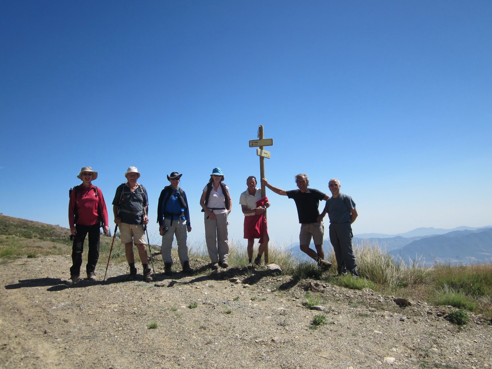
The walkers; Mike, Kees, Ray, Graham, Rene, Mark, and myself.
Distance walked on route today,7.1 km. Total distance today 21.5 km. Height climbed today 1209 metres. Total distance walked on the Sulayr path 291.9 km. Distance left to do 8.1 km. Total height climbed 23809 metres. Total distance walked 656.1 km.
No comments:
Post a Comment